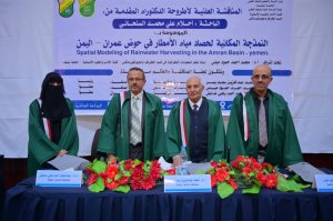
PhD Degree Awarded to Ms. Ahlam Ali Al-Sanhani in Geography and Geoinformatics

Ms. Ahlam Ali Mohammed Al-Sanhani was awarded a PhD degree in Geography and Geoinformatics – Water Resources for her dissertation titled: Spatial Modelling for Rainwater Harvesting in Amran Basin – Yemen, which was submitted to the Department of Geography and Geoinformatics, Faculty of Arts and Humanities – Sana’a University. The dissertation defense was held on Tuesday, November 18, 2025.

The PhD Viva-Voce Committee, which was formed based on a resolution issued by the Graduate Studies and Scientific Research Council, consisted of the following:
| # | Committee Members | Designation | Position |
| 1 | Prof. Mohammed Abdulaziz Saad Yasar | Internal Examiner | Chair |
| 2 | Prof. Mohammed Ahmed Hamoud Mayas | Main Supervisor | Member |
| 3 | Assoc. Prof. Abdulmajid Ahmed Yahya Madaghesh | External Examiner | Member |
The study aimed to:
- Develop a spatial suitability model for identifying optimal rainwater-harvesting sites based on a set of natural and human criteria.
- Produce a spatial suitability map for water-harvesting structures according to weighted importance levels, using the Analytical Hierarchy Process (AHP) within a multi-criteria decision support system in a GIS environment.
The study yielded a number of key findings summarized as follows:
- Amran Basin lies within Yemen’s western highlands, extending from Bani Matar District in the south to Al-Mahtama District in the north and east, with an estimated area of 2,110 km². It is a structural depression surrounded by steep highlands.
- Three levels of spatial suitability for rainwater-harvesting structures were identified based on 11 major criteria. The most influential criteria in determining optimal sites were: rainfall intensity, slope degree, land cover, slope aspect, geological formations, and surface runoff volume.
- The number of sites classified as low, medium, and high suitability were 91 sites, 895 sites, and 58 sites, respectively.
- The main watercourse contained the highest number of suitable sites (25 sites), followed by the western and eastern Al-Bawn sub-basins with 11 and 8 sites respectively.
- GIS and remote sensing techniques were found to be important in data preparation, processing, analysis, and visualization, given their critical role in supporting future planning for water-resource management projects, particularly rainwater-harvesting initiatives that help combat desertification and reduce drought impacts in Amran Basin.
In light of these findings, the researcher recommended:
- Encouraging and supporting applied research in the field of water resources through the provision of necessary data.
- Maintaining existing climate-monitoring stations in Amran Basin and establishing hydro-meteorological monitoring stations in secondary basins to record rainfall and predict surface runoff for improved water-resource management.
- Supporting and encouraging residents of Amran Basin who wish to construct rainwater-harvesting facilities.
- Maintaining and rehabilitating existing rainwater-harvesting structures in the basin to ensure their continued effectiveness.
- Utilizing the potential sites identified in the study when determining the types of water-harvesting facilities to be developed by local authorities.
The dissertation defense was attended by a number of academics, researchers, and specialists, students, colleagues, and the researcher’s family.

")
")
