Field Practicum for Geography and Geoinformatics Students: Mastering Total Station Technology
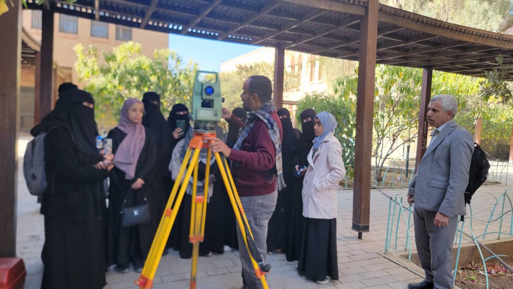
The Department of Geography and Geoinformatics at Sana’a University conducted a comprehensive field training session for students across all academic levels. Held at the Faculty of Engineering laboratories, the session focused on the practical application of Total Station technology, as part of the department’s mission to bridge theoretical knowledge with professional field practice.
The training aimed to equip students with essential skills in modern surveying equipment used for cadastral surveys and topographic mapping. Students received hands-on experience with the Total Station—a sophisticated electronic instrument that integrates horizontal and vertical angle measurements with high-precision laser distance measurement. This technology is widely utilised in engineering construction, site positioning, mapping, and structural monitoring.
This programme is a core element of the Department’s vision to produce highly qualified graduates proficient in Geoinformatics, Geographic Information Systems (GIS), and Remote Sensing. It ensures that students can professionally execute surveying tasks using advanced instruments, aerial imagery, and digital mapping techniques.
The session was conducted under the supervision of Dr. Mohammed Al-Bakri, Head of the Department of Geography and Geoinformatics, with the participation of Dr. Hafidha Qasim, Professor of GIS and Remote Sensing, alongside several specialised faculty members.
Such practical initiatives reflect Sana’a University’s ongoing efforts to align academic curricula with contemporary labour market requirements, ensuring graduates are fully prepared for professional careers in applied geography and geoinformatics.


You may also like

PhD Degree Awarded to Ms. Alimah Ibrahim Mohammed Al-Selwi
25 February, 2026

