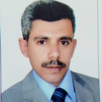
محمد أحمد حمود مياس
البيانات الشخصية:
الاسم: محمد أحمد حمود مياس
تاريخ الميلاد: 3/4/1972
محل الميلاد: صنعاء، الجمهورية اليمنية
الحالة الاجتماعية: متزوج
الوظيفة: رئيس قسم الجغرافيا والجيوانفورماتكس كلية الآداب والعلوم الإنسانية، جامعة صنعاء
العنوان الدائم: صنعاء – حي الوحدة – شارع رقم 6 تقاطع شارع عمان مع شارع الجزائر
رقم الهاتف: +967-770002121
E-mail mmaiyas@gmail.com
الصفة:أستاذ مشارك بقسم الجغرافيا والجيوانفورماتكس
ملخص:
خريج قسم الجغرافيا والجيوانفورماتكس عام 1995م، تعين معيداً في القسم، أبتعث إلى ماليزيا للدراسات العليا الماجستير والدكتوراه، درس في جامعة بوترا ماليزيا بكلية الهندسة، خبير في تقنية الاستشعار عن بعد وأنظمة المعلومات الجغرافية والنمذجة الرقمية والمكانية، وتحليل مرئيات الرادار و المرئيات الفضائية، وخبير في أنظمة دعم القرارات المكانية، والتحليل الإحصائي المكاني.
المؤهلات العلمية:
قسم الجيوانفورماتكس والاستشعار عن بعد – كلية الجغرافيا – جامعة وارسو – بولندا
2013-2014 دراسات مابعد الدكتوراه
عنوان البحث: تحديد الخصائص الطيفية للمعادن في محمية كاركونوجه الوطنية في بولندا من المرئيات فائقة الأطياف للمجس APEX
الهدف من الدراسة هو استخراج بعض أنواع المعادن بناءً على بيانات الانعكاس الطيفي للمعادن من المرئيات فائقة الأطياف HSI وقسمت الدراسة إلى ثلاثة أجزاء: تطبيق طريقة التصحيح السريع للغلاف الجوي (QUAC) وطريقة الحد الأدنى من كسر الضوضاء (MNF) لتصحيح تأثير الغلاف الجوي. استخراج المعادن من مرئيات (HIS) ، وتصنيف المرئية بناءً على الإنعكاسات الطيفية للمعادن باستخدام مخطط الزوايا الطيفية (SAM).
عنوان البحث: بناء مرجعية للانعكاسات الطيفية لعدة معادن مختارة استنادا إلى القياسات المعملية بمقياس الطيف التحليلي للأجهزة الطيفية (ASD) FieldSpec-3
الهدف: من الدراسة هو بناء مكتبة طيفية لكل من معادن الكوارتز أفينتورين، والجرانيت، وأوليفين، والبيريت، والهيماتيت، والكلوريت، وقد تم إجراء القياس المعملي داخل متحف الجيولوجيا في كلية الجيولوجيا، جامعة وارسو باستخدام مقياس الطيف التحليلي للأجهزة الطيفية (ASD) FieldSpec-3 في المدى الطيفي الذي يتراوح بين (0.35 ميكرومتر) و (1.85 ميكرومتر).
مركز إدارة البحوث (RMS) جامعة بوترا – ماليزيا
2007-2008 دراسات مابعد الدكتوراه
عنوان البحث: تطبيق المنهجية المرجحة مع طريقة التحليل الهرمي (AHP) داخل نظم المعلومات الجغرافية لتصنيف مناطق التنوع البيولوجي للنباتات في جزيرة لانكاوي ، ماليزيا.
تم تطبيق المنهجية المرجحة مع طريقة التحليل الهرمي (AHP) لتصنيف مناطق الغطاء النباتي للتنوع البيولوجي في جزيرة لانكاوي في ماليزيا ، بناءً على ثلاثة عوامل (كثافة الغطاء النباتي ، ومناطق التخلخل الحيوي ، وتعقيد التضاريس). أجريت عينات ميدانية لجمع المعلومات على عدد الأنواع النباتية باستخدام نظام GPS ومقياس الإشعاع الطيفي Spectro-radiometer ومقارنة الانعكاس الطيفي للعمل الميداني مع الانعكاس الطيفي لمرئية القمر الصناعي SPOT-5 وتم استخدام مؤشر شانون ويفر.
قسم هندسة نظم المعلومات الجغرافية – كلية الهندسة – جامعة بوترا – ماليزيا
2004-2007 أطروحة الدكتوراه
عنوان الأطروحة: تطوير نموذج لقياس واستخراج أنماط تيارات سطح المحيط من مرئيات RADARSAT-1 SAR وبيانات مقياس الارتفاع (التيميتر)
الهدف من الدراسة هو تطوير نموذج قوي يعتمد على إزاحة تردد دوبلر من مرئيات RADARSAT-1 SAR لقياس أنماط تيار سطح البحر (السرعة والاتجاه). تم تطبيق النموذج على ثلاث صور مختلفة (WIDE-3 و HIGHEXTENDED-6 و STANDARD-2). تم تقسيم المنطقة إلى أربعة أجزاء رئيسية تشمل الساحل ومنطقة العمل الميداني والساحل الأوسط والبحري. تم استخدام التحليل الإحصائي لتحديد معامل السرعات المستخرجة من بيانات SAR ومقارنتها بقياسات تيار المحيط التي تم قياسها بواسطة AWAC أثناء العمل الميداني.
قسم نظم المعلومات الجغرافية والاستشعار عن بعد – كلية الهندسة – جامعة بوترا – ماليزيا
2002-2003 رسالة الماجستير
عنوان الرسالة: تطوير منهجية علمية للتعرف على الامتداد العمراني في مدينة صنعاء من عام 1988 إلى عام 1998 باستخدام تقنيات الاستشعار عن بعد ونظم المعلومات الجغرافية
الهدف من الدراسة هو تطوير منهجية علمية للتعرف على الامتداد العمراني في مدينة صنعاء من عام 1988 إلى عام 1998 باستخدام تقنيات الاستشعار عن بعد ونظم المعلومات الجغرافية. تم استخدام صور LandSat5 للتعرف على النمو الحضري وتمت مناقشة التغيرات العمرانية المكانية والزمانية في الدراسة
المركز الأمريكي اليمني (AMIDEAST)
2001 التوفل الدولي INTERNATIONAL COMPUTER-BASED TOEFL
المعهد اليمني الأمريكي للغات (YALI)
1999-2001 دورات في تعلم اللغة الأنجليزية
معهد لندن للكمبيوتر – صنعاء – اليمن
1994 WINDOWS 95 AND MS OFFICE COURSES
Microsoft Windows 95, DOS, MS Word, MS Excel
قسم الجغرافيا – كلية الآداب – جامعة صنعاء – اليمن
1992-1995 ليسانس من قسم الجغرافيا – كلية الآداب – جامعة صنعاء، الأول على دفعتي وتم تعييني معيد في عام 1996م
الخبرات:
نوفمبر 2020 إلى الآن رئيس قسم الجغرافيا والجيوانفورماتكس بكلية الآداب والعلوم الإنسانية – جامعة صنعاء – اليمن
أكتوبر 2020 إلى الآن خبير برمجيات نظم المعلومات الجغرافية ، مستشار ومدرب في شركة ناتكو ، اليمن
2019-2020 رئيس وحدة التطوير الأكاديمي وضمان الجودة ، كلية الآداب والعلوم الإنسانية ، جامعة صنعاء
2018 إلى الآن باحث في مشروع (EMME) (الإدارة البيئية في الشرق الأوسط – المناهج المكانية) Lund University ، السويد برنامج التمويل الأوروبي الأوروبي.
2017 إلى الآن نائب رئيس اتحاد الأكاديميين العرب لشؤون الابتكار
2014 أستاذ مشارك بقسم الجغرافيا ، كلية الآداب والعلوم الإنسانية ، جامعة صنعاء
2013-2014 دراسات مابعد الدكتوراه بقسم الجيوانفورماتكس والاستشعار عن بعد – كلية الجغرافيا – جامعة وارسو – بولندا
2010-2013 رئيس قسم الجغرافيا بكلية الآداب والعلوم الإنسانية – جامعة صنعاء – اليمن
2010 عضو اللجنة العلمية للمؤتمر العلمي الرابع للجغرافيين اليمنيين ، قسم الجغرافيا، كلية الآداب والعلوم الإنسانية، جامعة صنعاء
2009-2010 رئيس لجنة العقوبات بالكنترول ، كلية الآداب والعلوم الإنسانية والدراسات الإنسانية ، جامعة صنعاء
2009-2010 معد الخرائط لأطلس صور الأقمار الصناعية للجمهورية اليمنية ومستشار ومدرب مركز الاستشعار عن بعد، وزارة الاتصالات وتكنولوجيا المعلومات، اليمن
2008-2013 عضو لجنة الامتحانات بالكنترول، كلية الآداب والعلوم الإنسانية ، جامعة صنعاء
2008-2014 أستاذ مساعد بقسم الجغرافيا ، كلية الآداب والعلوم الإنسانية ، جامعة صنعاء
2007-2008 رئيس فريق العمل الميداني وجمع البيانات لمشروع السياحة البيئية والتنوع البيولوجي في جزيرة لانكاوي ، مركز إدارة البحوث (RMC) ، جامعة بوترا ماليزيا
2007-2008 باحث ما بعد الدكتوراه ، مشروع السياحة البيئية والتنوع البيولوجي في جزيرة لانكاوي ، مركز إدارة البحوث (RMC) ، جامعة بوترا ماليزيا
1996-2001 معيد بقسم الجغرافيا ، كلية الآداب والعلوم الإنسانية ، جامعة صنعاء
1995-2001 رئيس لجنة الرقابة والمتابعة بالجمعية الجغرافية اليمنية
1993-1995 رئيس الجمعية الجغرافية الطلابية بكلية الآداب والعلوم الإنسانية جامعة صنعاء
1990 خدمة التدريس الإجباري ، وزارة التربية والتعليم ، اليمن.
المشاركات: المؤتمرات/ الورش العلمية/ السمنارات
8-19 سبتمبر 2020 أسبوع الابتكار IWA 2020 الذي نظمته OFEED تحت رعاية الاتحاد الدولي لجمعيات المخترعين (IFIA) والشركاء الرئيسيين: Oxford Business Group – The Patent Magazine – CGEM ( (المغرب)
28-31 أغسطس 2020 مسابقة البحث الدولية للعلماء الشباب (IRCYS) ، باندونغ ، إندونيسيا
7-11 فبراير 2020 ورشة عمل لإعداد توصيف المقررات الأكاديمية لبرامج أقسام كلية الآداب والعلوم الإنسانية ، جامعة صنعاء ، اليمن (رئيس وحدة التطوير الأكاديمي وضمان الجودة)
15-18 يناير 2019 ورشة عمل اعداد برامج الاقسام بكلية الآداب والعلوم الانسانية ، جامعة صنعاء ، اليمن (رئيس وحدة التطوير الأكاديمي وضمان الجودة بكلية الآداب والعلوم الإنسانية)
26-27 ديسمبر 2019 ورشة عمل لتحديد المعايير الوطنية لخريجي كلية الآداب والعلوم الإنسانية ، جامعة صنعاء ، اليمن (رئيس وحدة التطوير الأكاديمي وضمان الجودة بكلية الآداب والعلوم الإنسانية)
19-21 نوفمبر 2019 ورشة عمل لإعداد إستراتيجية كلية الآداب والعلوم الإنسانية ، جامعة صنعاء ، اليمن (رئيس وحدة التطوير الأكاديمي وضمان الجودة بكلية الآداب والعلوم الإنسانية)
27-31 أغسطس 2019 ورشة التنوع الحيوي في محمية البرعة اليمنية ، الذي نظمه برنامج إيراسموس التابع للاتحاد الأوروبي، المشروع المشترك (EMME) الإدارة البيئية في الشرق الأوسط – المنهجية المكانية
5-7 مايو 2014 المؤتمر الأول للجغرافيا من أجل التنمية ، كلية الآداب ، جامعة دهوك ، كردستان ، العراق
20 نوفمبر 2013 ورشة عمل “Connect4Climate” ، التي نظمها البنك الدولي ، كلية الجغرافيا والدراسات الإقليمية ، جامعة وارسو ، بولندا
27-29 ديسمبر 2010 المؤتمر العلمي الرابع للجغرافيين اليمنيين ، قسم الجغرافيا ، كلية الآداب والعلوم الإنسانية ، جامعة صنعاء
3-8 يونيو 2010 ورشة عمل تطوير برنامج قسم الجغرافيا ، قسم الجغرافيا ، كلية الآداب والعلوم الإنسانية ، جامعة صنعاء
9 أغسطس 2008 الندوة الوطنية: “حفظ التنوع البيولوجي من أجل السياحة البيئية ، وحماية موارد الأخشاب والأنواع” ، جامعة بوترا ماليزيا ، كوالالمبور ، ماليزيا
نوفمبر 2007 ورشة عمل الجمعية الدولية للمسح التصويري والاستشعار عن بعد (ISPRS) ، جامعة بوترا ماليزيا ، كوالالمبور ، ماليزيا
13-15 سبتمبر 2007 الندوة والمعرض الدولي السادس للمعلومات الجغرافية (ISG 2007) ، جوهور باهرو ، ماليزيا
نوفمبر 2006 الندوة الوطنية الرابعة للاستشعار عن بعد بالموجات الدقيقة ، MACRES ، كوالالمبور ، ماليزيا
22-24 أغسطس 2006 معرض التصميم والبحث والابتكار ، مركز إدارة البحوث ، جامعة بوترا ماليزيا ، كوالالمبور ، ماليزيا
8-9 ديسمبر 2005 ورشة عمل لجنة ISPRS 11/4 حول التخطيط المكاني ونظام دعم القرار ، المركز الماليزي للاستشعار عن بعد (MACRES) ، ماليزيا
6-8 ديسمبر 2005 مؤتمر الهندسة المكانية والحاسوبية ، المؤتمر الدولي للتكنولوجيا المتقدمة ، بوترا جايا ، ماليزيا
27-29 سبتمبر 2005 الندوة والمعرض الدولي الرابع للمعلومات الجغراف (ISG 2005) ، باتو فيرينغي، بولاو بينانغ، ماليزيا
15, 22, 29 سبتمبر 2005 ورشة عمل “كتابة أطروحة جيدة” ، جامعة بوترا ماليزيا
26-28 أغسطس 2005 مؤتمر اليمنيون الحضرميون في جنوب شرق آسيا: الحفاظ على الهوية أو الاستيعاب: “المؤتمر الدولي” ، الجامعة الإسلامية العالمية ، كوالالمبور ، ماليزيا
أبريل 2005 المؤتمر والمعرض الماليزي الرابع للاستشعار عن بعد ونظم المعلومات الجغرافية ، كوالالمبور
11 -13 أكتوبر 2004 المؤتمر الدولي للعلوم ، صنعاء ، اليمن
21-23 سبتمبر 2004 الندوة والمعرض الدولي الثالث للمعلومات الجغرافية (ISG 2004) ، كوالالمبور ، ماليزيا
3 سبتمبر 2004 سلسلة من الندوات في “حدود العلوم والتكنولوجيا المتقدمة” ، معهد التكنولوجيا المتقدمة (ITMA) ، جامعة بوترا ماليزيا ، كوالالمبور ، ماليزيا
13-14 أكتوبر 2003 الندوة والمعرض الدولي الثاني للمعلومات الجغرافية (ISG 2003) شاه علم ماليزيا
5-7 أكتوبر 2003 Konvensyen Dunia Melayu Dunia Islam (KE-4), organized by Pusat Dagangan Antarabangasa Melaka, Ayer Keroh, Melaka, Malaysia
16-19 نوفمبر 1998 المؤتمر الجغرافي العربي ، صنعاء ، اليمن
22 سبتمبر 1998 المؤتمر العام الثالث للجمعية الجغرافية اليمنية صنعاء
الموسم الثالث 1993 إلى الموسم العاشر 2000 المواسم الثقافية الرمضانية السنوية
5 ديسمبر 1997 ورشة عمل الدراسات الديموغرافية ، الجهاز المركزي للإحصاء ، صنعاء ، اليمن
23-25 أكتوبر 1995 المؤتمر التكتوني والحواف للبحر الأحمر وخليج عدن ، جامعة صنعاء ، اليمن
4 أغسطس 1995 المؤتمر العام الثاني للجمعية الجغرافية اليمنية صنعاء – اليمن
الخبرات العلمية:
• خبير في تقنية الاستشعار عن بعد وأنظمة المعلومات الجغرافية.
• تحليل مرئيات الرادار و المرئيات الفضائية.
• خبير في أنظمة دعم القرارات المكانية.
• التحليل الإحصائي المكاني
• النمذجة الرقمية والمكانية.
عضوية الهيئات والجمعيات العلمية:
• عضو الجمعية الدولية للاستشعار عن بعد والتصوير الجوي (International Society of photogrammetry and Remote Sensing ISPRS) 2007 حتى الآن.
• عضو الجمعية الأمريكية للعلماء والمهنيين اليمنيين. 2006 حتى الآن.
• عضو نقابة أعضاء هيئة التدريس بجامعة صنعاء. 1997 حتى الآن.
• عضو لجنة الكنترول بكلية الآداب – جامعة صنعاء من 1996 إلى 2001.
• عضو الجمعية الجغرافية اليمنية – من 1993 حتى الآن.
• نائب رئيس اتحاد الأكاديميين العرب لشؤون الإبتكارات من 2017 حتى الأن.
مدرب لأنظمة الجيوانفورماتكس
أكتوبر 2020 مستشار ومدرب لبرنامج (ARCGIS) شركة ناتكو لتكنولوجيا المعلومات – اليمن
أبريل 2019 دورة تدريبية متقدمة لموظفي إدارة الخرائط بالجهاز المركزي للإحصاء ، صنعاء ، اليمن بعنوان “طرق التحليل الجغرافي الإحصائي المكاني في برمجيات ArcGIS”
نوفمبر 2017 دورة تدريبية لطلاب الدراسات العليا بقسم الآثار جامعة صنعاء بعنوان “التطبيقات الأساسية في برنامجي Erdas و ArcGIS”
مايو 2016 دورة تدريبية لموظفي شركة MTN “إنشاء شبكات البث والتغطية باستخدام برنامج ArcGIS”
أغسطس 2009 دورة تدريبية متقدمة لموظفي القسم الفني بشركة Total Oil Company في اليمن بعنوان “إنشاء قواعد البيانات والتحليل المكاني في برنامج ArcGIS”
يناير 2009 دورة تدريبية لموظفي مركز الاستشعار عن بعد ، صنعاء ، اليمن بعنوان “التطبيقات الأساسية في برمجيات Erdas و ArcGIS”
المقررات التي درستها
برنامج البكالوريوس
• تطبيقات متقدمة للاستشعار عن بعد ونظم المعلومات الجغرافية
• برمجة بايثون لنظام المعلومات الجغرافية
• الاستعلام والتحليل المكاني في برنامج ArcGIS
• أنظمة دعم القرار المكاني (SDSS)
• المساحة الأرضية والتصوير الجوي
• أسس الاستشعار عن بعد
• معالجة الصور الرادارية والحرارية
• الإحصاء المتقدم
• تطبيقات متقدمة في نظم المعلومات الجغرافي
• تطبيقات متقدمة في الاستشعار عن بعد
برنامجي الماجستير والدكتوراه
• تطبيقات متقدمة للاستشعار عن بعد ونظم المعلومات الجغرافية
• الإحصاء المتقدم
اللغات التي أجيد التحدث بها
• اللغة العربية (كتابةً ونطقاً)
• اللغة الإنجليزية (كتابةً ونطقاً)
برامج الجيوانفورماتكس
برامج الإستشعار عن بعد ومعالجة الصور الرقمية
• ERDAS Imagine, ENVI, PCI Geomatica, eCognition Developer, IDRISI
• ENVI
• PCI Geomatica
• Developers Ecognition
• IDRISI
• Global Mapper
برامج نظم المعلومات الجغرافية و نظم دعم القرار
• ArcGIS Desktop
• QGIS
• Expert Choice
برامج التحليل الإحصائي و البرمجة
• SPSS
• Minitab
• Origin Pro
• Python
البحوث والأوراق العلمية:
Maiyas, M, A. (2021) “Extraction of Sea Surface Current Pattern in Bab Al-Mandab Strait using Radar Sentinel-1 C-band SAR Image” Journal of Al-Maharah), No (9) Pp: 14
Maiyas, M, A. (2021) “The geostrategic importance of the Socotra archipelago, the Yemeni coasts and islands, and the Emirati and Zionist ambitions to control them” Journal of Political paradoxes, No (8) Pp: 18
Maiyas, M, A. (2020) “Building Hyperspectral Signatures Library to Identify some Selected Minerals Based on Laboratory Measurements using (ASD) FieldSpec-3 Spectroradiometer”, Journal of Faculty of Arts and Humanities, Sana’a University, No (44), pp: 181-198
Maiyas, M, A. (2020) “Geospatial Analysis to Recognize the 2016-2017 Yemeni Cholera Epidemic – A Case Study of Sana’a City and Districts of Sana’a Governorate” Civilization University of Applied and Humanitarian Researches, Vol (1) Issue:2 Pp: 273-288
Maiyas, M, A. (2019) “Spectral properties analysis of minerals in the Karkonosze National Reserve in Poland from the Hyper-spectral image of the APEX sensor”. Journal of Arts, Vol (13), pp:372-385
Maiyas, M, A. & Zagajewski, B. (2014) “Hyperspectral signal identification of minerals of the karkonosze national park from apex sensor image”, Proceedings of the Geography and Development Conference, 5-7 May, 2014, Duhok University, Iraq.
Maiyas, M, A. (2013). “Developing of a model to extract surface temperature from Landsat-TM and Landsat-ETM Images”. Proceeding of The 4th Conference of Yemeni Geographers, vol(3), pp. 43-71. It was also published in Journal of Humanity Science, vol (9), 2013, Taiz, Yemen
Maiyas, M, A. (2013). “Basics of remote sensing”, Book, 394 pp
Maiyas, M, A., Mansor, S., Nur M. N. (2013) “Applying Weighted Corresponding Methodology with Analytical Hierarchy Process (AHP) within GIS for Classification of Vegetation Biodiversity Areas in Langkawi Island, Malaysia”, Arabian Journal of GIS, Riyadh, Saudi Arabia, vol(5) no(2), pp. 40-68.
Maiyas, M, A. Mansor, S., Helmi Zulhaidi, M, S. (2012) “A Robust Model for Measuring and Extracting Ocean Surface Current Patterns from RADARSAT-1 SAR Images”, Arabian Journal of GIS, Riyadh, Saudi Arabia, vol (5) no (1), pp. 25-42.
Maiyas, M, A. (2010) “Developing of a model to extract surface temperature from Landsat-TM and Landsat-ETM Images”. 4th Yemeni Geographers Conference, Sana’a University, Yemen
Maiyas, M, A., Mansor, S., Nur M. N., (2009) “Analytical hierarchical network for generalized plant biodiversity richness characterization at landscape level”, International Journal of Remote Sensing, submitted in 2009
Mohamed Maiyas, Shattri Mansor, Maged Marghany, Helmi Zulhaidi Bin Mohd Shafri, Zailani Khuzimah (2007) “Spectral Intensity of Radar Backscatter for Extracting Sea Surface Current Pattern from SAR Imageries” International Symposium For Geoinformatics (ISG 2007) Johor Bahro, Malaysia.
Maiyas, M, A., Mansor, S., Marghany, M, Helmi Z, S., (2007) “A Robust Model for Simulating Sea Surface Current from RADARSAT-1 SAR Data”. IEEE – IGARSS07, 23-27 July 2007. Barcelona, Spain
Maiyas, M, A., Mansor, S., Marghany, M, Helmi Z, S., (2007) “Ocean Surface Current Information from SAR imageries”. ISPRS, International Society of photogrammetry and Remote Sensing Conference, Beijing, China, 17-19 July 2007
Maiyas, M, A., Al-Mahfadi, A. (2007). “Heuristic Approach to Urban Sprawl Recognition Using RS & GIS Techniques”. Journal of Science and Technology, vol (12), no (1), pp. 20-31
Maiyas, M, A., Mansor, S., Marghany, M, Helmi Z, S., (2005) “Extraction of Sea Surface Wind and Current patterns from RADARSAT-1 SAR Imagery”. International Symposium for Geoinformatics (ISG 2005) 27-29 September 2005, Batu Feringghi, Pulau Pinang, Malaysia.
Maiyas, M, A. & Mansor, S., (2004) “Using RADARSAT-1 SAR Imagery in Oceanography Operations”. Paper presented in International Science Conference, 11-13 October 2004, Sana’a, Yemen
Resume of Dr. Mohamed Ahmed Maiyas
PERSONAL DETAIL
Name Mohamed Ahmed Maiyas
Date of Birth 03/04/1972
Place of Birth Sana’a, Republic of Yemen
Address 49-Amman Street, Al-Wahdah Zone, Sana’a, Republic of Yemen
Phone 00967-770002121
Nationality Yemeni
E-mail mmaiyas@gmail.com
Occupation Associated Professor, Head of Remote Sensing and GIS Unit, Geography and GeoInformatics
Department, Faculty of Arts and Humanities, Sana’a University, Yemen
EDUCATION QUALIFICATIONS
DEPARTMENT OF GEOINFORMATICS, CARTOGRAPHY AND REMOTE SENSING, UNIVERSITY OF WARSAW, POLAND
2013-2014 POSTDOCTORAL
Research Title: Determination of spectral Signatures of minerals in Karkonosze National Park in Poland from Hyper-Spectral Imaging of APEX Sensor.
The study aims to extract some types of minerals based on spectral reflection data of minerals from HSI imageries. The study divided into three parts: applying the Quick Atmosphere Correction (QUAC) method and the Minimum Noise Fraction (MNF) method to correct the atmospheric effect. extracting minerals from (HIS) imageries, and displaying the classification of the hyper-spectral image based on spectral signatures of minerals using Spectral Angle Mapper (SAM).
Research Title: Building Endmembers Hyper-spectral Library to Identify Minerals Based on Laboratory Measurements Data.
This experimental is a test for seven different samples of rock and minerals. The experiment aims to build and maintain end-members spectral library for quartz aventurine, granite, olivine, pyrite, hematite, and chlorite. The laboratory measurement was performed inside the Geology Museum at the Faculty of Geology, Warsaw University, using the spectrometer Analytical Spectral Devices (ASD) FieldSpec-3 at spectral range averaged between (0.35 µm) to (1.85 µm).
RESEARCH MANAGEMENT CENTER (RMC), UNIVERSITY PUTRA MALAYSIA
2007-2008 POST-DOCTORAL AND RESEARCHER
Research Title: Applying Weighted Corresponding Methodology with Analytical Hierarchy Process (AHP) within GIS for Classification of Vegetation Biodiversity Areas in Langkawi Island, Malaysia.
The weighted corresponding methodology with the Analytical Hierarchy Process (AHP) was applied to classify the areas of biodiversity vegetation on the island of Langkawi in Malaysia, based on three factors (vegetation density, bio-disturbance areas, and terrain complexity). Field samplings were conducted to collect ground information on plant species number using GPS and Spectro-radiometer and compared spectral reflectance with reflectance of spatial resolution of SPOT-5 image. Shannon-Weaver Index, Maximum Likelihood Supervised Classification, Spatial filtering, DEM modeling were used in this study.
GIS AND GEOMATIC ENGINEERING, FACULTY OF ENGINEERING, (UPM), MALAYSIA
2004-2007 PH.D.
Thesis Title: Developing of a Model for Measuring and Extracting Ocean Surface Current Patterns from RADARSAT-1 SAR Images and Altimeter Data.
A robust model was developed based on Doppler frequency shift that utilizes RADARSAT-1 SAR imageries to measure the sea surface current patterns (velocity and direction). The model applied to three different RADARSAT-1 SAR images (Wide-3, HighExtended-6, and Standard-2). The area was divided into four main parts comprising the onshore, fieldwork area, mid-shore, and offshore. Statistical analysis was used to establish the coefficient of determination between the velocities extracted from SAR data and the real ocean current measurements measured by AWAC during the in-situ measurements.
REMOTE SENSING AND GIS, FACULTY OF ENGINEERING, (UPM), MALAYSIA
2002-2003 MASTER OF SCIENCE
Thesis Title: Heuristic Approach to Urban Sprawl Recognition using Remote Sensing and GIS Techniques.
A heuristic approach was developed to urban sprawl recognition in Sana’a City from 1988 to 1998 using remote sensing and GIS techniques. LandSat5 images were used in urban pattern recognition. Spatial and temporal urban changes are discussed in the study.
AMERICAN MIDDLE EAST (AMIDEAST), YEMEN
APRIL 2001 INTERNATIONAL COMPUTER-BASED TOEFL
YEMEN-AMERICAN LANGUAGE INSTITUTE (YALI), SANA’A, YEMEN
1999-2001 ENGLISH COURSES
(Access B) on November 10th 1999 to level (4B) on January 7th 2001
LONDON INSTITUTE, YEMEN
1994 WINDOWS 95 AND MS OFFICE COURSES
Microsoft Windows 95, DOS, MS Word, MS Excel
GEOGRAPHY DEPARTMENT, FACULTY OF ARTS, SANA’A UNIVERSITY, YEMEN
1991-1995 B.A
In 1994-1995 I was the first in my class, and I was appointed as a Teaching Assistant in the Department of Geography in 1996
EMPLOYMENT HISTORY
2020 NOVEMBER- PRESENT Head of Geography and Geoinformatics Department, Faculty of Arts and Humanities, Sana’a University
2020 OCTOBER- PRESENT Geoinformatics Method and Software Expert, consultant and Trainer at NATCO Company, Yemen
2019- PRESENT Head of Academic Development and Quality Assurance Unit, Faculty of Arts and Humanities, Sana’a University
2018- PRESENT Main partner and researcher by the (EMME) project (Environmental management in the Middle East – spatial approaches) Lund University, Sweden EU European funding programme.
2017- PRESENT Vice President of the Arab Academics Union for Innovation Affairs
2014 Associate Professor, Geography Department, Faculty of Arts and Humanities, Sana’a University,
2013-2014 Post-doctoral, Department of Remote Sensing, University of Warsaw.
2010-2013 Head of Geography Department, Faculty of Arts and Humanities, Sana’a University.
2010 Member of Scientific Committee of The 4th Scientific Conference of Yemeni Geographers, Geography Department, Faculty of Arts and Humanities, Sana’a University.
2009-2012 Chair of the Investigation Committee, Faculty of Arts and Humanities and Humanity Studies, Sana’a University.
2009-2010 Member of Committee of the Satellite Image Atlas of the Republic of Yemen, Ministry of Communication and Information Technology, Yemen.
2009-2010 Determinant of Geography Department, Faculty of Arts and Humanities, Sana’a University.
2008-2013 Member of the Examination Committee, Faculty of Arts and Humanities, Sana’a University.
2008- 2014 Assistant Professor, Geography Department, Faculty of Arts and Humanities, Sana’a University.
2008-2009 Consultant and trainer of GIS and remote sensing software, Yemeni Centre of Remote Sensing and GIS.
2007-2008 Head of fieldwork and data collection team for ecotourism and biodiversity project in Langkawi Island, Research Management Center (RMC), University Putra Malaysia.
2007-2008 Post-doctoral and Researcher, Ecotourism and Biodiversity Project in Langkawi Island, Research Management Center (RMC), University Putra Malaysia.
2006 Head of preparation committee for Yemeni Student Union in Malaysia
1996-2001 Teaching Assistant, Geography Department, Faculty of Arts and Humanities, Sana’a University.
1995- 2001 Head of the Monitoring & Follow up Committee, Yemeni Geographical Society.
1993-1995 Head of the Students Geographical Society, Faculty of Arts and Humanities, Sana’a University.
1990 Compulsory Teaching Service, Ministry of Education, Yemen
PARTICIPATIONS: SEMINAR/CONFERENCE/WORKSHOP
SEPT. 8TH TO 19TH 2020 Innovation Week IWA 2020 organized by OFEED under the Patronage of the International Federation of Inventors’ Associations (IFIA) and main Partners: Oxford Business Group – The Patent Magazine – CGEM (Morocco)
AUGUST, 28TH TO 31RST 2020 International Research Competition for Young Scientists (IRCYS), Bandung, Indonesia
FEBRUARY, 7TH TO 11TH 2020 A workshop for preparing academic courses at the College of Arts and Humanities, Sana’a University, Yemen (I was the Head of Academic Development and Quality Assurance Unit)
JANUARY, 15TH TO 18TH 2020 A workshop for preparing departmental programs of the College of Arts and Humanities, Sana’a University, Yemen (I was the Head of Academic Development and Quality Assurance Unit)
DEC. 26TH TO 27TH 2019 A workshop for determining national standards of graduates of the Faculty of Arts and Humanities, Sana’a University, Yemen (I was the Head of Academic Development and Quality Assurance Unit)
NOVEMBER, 19TH TO 21ST 2019 A workshop for strategy preparation of Faculty of Arts and Humanities, Sana’a University, Yemen (I was the Head of Academic Development and Quality Assurance Unit)
AUGUST, 27TH TO 30TH 2019 Biodiversity in the Yemeni Bura’a Reserve, organized by ERASMUS Program of European Union, the common project is named EMME (Environmental Management in the Middle East – Spatial Approaches)
MAY, 5TH TO 7TH 2014 The 1st Conference of Geography for Development, Faculty of Arts, Duhok University, Kurdistan, Iraq.
NOVEMBER, 20TH 2013 Workshop “Connect4Climate”, organized by The World Bank, Faculty of Geography and Regional Studies, University of Warsaw, Poland.
DECEMBER, 27TH TO 29TH 2010 The 4th Scientific Conference of Yemeni Geographers, Geography Department, Faculty of Arts and Humanities, Sana’a University.
JUNE, 3RD TO JULY 8TH 2010 Developing the Geography Department Program Workshop, Geography Department, Faculty of Arts and Humanities, Sana’a University.
SEPTEMBER, 13TH TO 15TH 2007 The 6th International Symposium and Exhibition on Geoinformation (ISG 2007), Johor Bahro, Malaysia
AUGUST, 9TH 2008 National Seminar: “Biodiversity Conservation for Ecotourism, Timber Resource and Species Protection”, University Putra Malaysia, Kuala Lumpur, Malaysia
NOVEMBER, 2007 International Society of photogrammetry and Remote Sensing workshop (ISPRS), University Putra Malaysia, Kuala Lumpur, Malaysia
NOVEMBER 2006 The 4th National Microwave Remote Sensing Seminar, MACRES, Kuala Lumpur, Malaysia.
AUGUST, 22ND TO 24TH 2006 Exhibition of design, research and innovation, Research Management Centre, University Putra Malaysia, Kuala Lumpur, Malaysia
DECEMBER, 8TH TO 9TH 2005 ISPRS Commission 11/4 workshop on Spatial Planning & Decision Support System, Malaysian Centre for Remote Sensing (MACRES), Malaysia
DECEMBER, 6TH TO 8TH 2005 Spatial and Computational Engineering Conference, International Advanced Technology Congress, Putra Jaya, Malaysia
SEPTEMBER, 27TH TO 29TH 2005 The 4th International Symposium and Exhibition on Geoinformation (ISG 2005), Batu Feringghi, Pulau Pinang, Malaysia
SEPTEMBER, 15TH, 22ND & 29TH 2005 “Writing a Good Thesis” workshop, University Putra Malaysia
AUGUST, 26TH TO 28TH 2005 Yemeni-Hadramis in Southeast Asia: Identity Maintenance or Assimilation: “International Conference”, International Islamic University, Kuala Lumpur, Malaysia
APRIL 2005 The 4th Malaysian Remote Sensing and GIS Conference & Exhibition, Kuala Lumpur
OCTOBER, 11RST 2004 International Science Conference, Sana’a, Yemen
SEPTEMBER, 21ST TO 23RD 2004 The 3rd International Symposium and Exhibition on Geoinformation (ISG 2004), Kuala Lumpur, Malaysia
SEPTEMBER, 3RD 2004 A Series of seminars in “Frontiers Science and Advanced Technology”, Institute of Advanced Technology (ITMA), University Putra Malaysia, Kuala Lumpur, Malaysia
OCTOBER 13RD TO 14TH 2003 The 2nd International Symposium and Exhibition on Geoinformation (ISG 2003), Shah Alam, Malaysia
OCTOBER, 5TH TO 7TH 2003 Konvensyen Dunia Melayu Dunia Islam (KE-4), organized by Pusat Dagangan Antarabangasa Melaka, Ayer Keroh, Melaka, Malaysia
NOVEMBER, 16TH TO 19TH 1998 Arab Geographical Conference, Sana’a, Yemen
SEPTEMBER, 22ND 1998 The 3rd General Conference of the Yemeni Geographical Society, Sana’a
3RD SEASON IN 1993 TO 10TH SEASON IN 2000 Annual Ramadan Cultural Seasons
DECEMBER, 5TH 1997 Demographic Studies workshop, the Central Organization for Statistics, Sana’a, Yemen
OCTOBER, 23RD TO 25TH 1995 Tectonic and Ridge of the Red-Sea and the Gulf of Aden conference, Sana’a University, Yemen
AUGUST, 4TH 1995 The 2nd General Conference of the Yemeni Geographical Society, Sana’a, Yemen
AWARDS
2006 Silver Medal from the Research Management Centre (RMS) for the innovation of (Image-based Ocean Surface Current Meter) at Pameran Reka Cipta, Penyelidikan Dan Inovasi (UPM).
SCHOLARSHIP AND PROJECTS
2013-2014 (Post-doctoral), ERAMUS MUNDUS, Department of Remote Sensing, Faculty of Geography and Regional Studies, University of Warsaw, Poland.
2007-2008 (Post-doctoral), Ecotourism and Biodiversity Project in Langkawi Island,
The Research Management Centre (RMS), Malaysia
2004-2007 (PhD), Admission scholarship, University Putra Malaysia
2004-2007 (PhD), Ministry of High Education and Scientific Research, Yemen
2002-2003 (MS.c), Admission scholarship, University Putra Malaysia
2002-2003 (MS.c), Ministry of High Education and Scientific Research, Yemen
1999-2001 (English Language), Admission scholarship, Yemen-American Language Institute (YALI), Yemen
1999-2001 (English Language), Ministry of Planning and Development, Yemen
MEMBERSHIPS
2017- Vice President of the Arabic Academy Union for Innovation
2006-2007 Member of Yemeni Student Union in Malaysia.
2004- Member of The American Association of Yemeni Scientists and Professionals.
2005- Member of Yemeni Youth Union, Yemen.
2005-2007 Member of Malaysian Remote Sensing Society (MRSS), Malaysia.
1997- Member of Sana’a University Lecturers Union, Sana’a University, Yemen.
1994- Member of Yemeni Geographical Society, Sana’a, Yemen.
TRAINER OF COURSES
OCTOBER 2020 ArcGIS Desktop consultant and trainer (Basic, intermediate and Advance) NATCO company, Yemen
APRIL 2019 Advanced training course for the officers of the Map Department at the Central Statistics Organization, Sana’a, Yemen entitled “Methods of geo-statistical Spatial analysis in ArcGIS software”
NOVEMBER 2017 Training course for graduate students at the Department of Archaeology, Sana’a University entitled “Basic Applications in Erdas and ArcGIS”
MAY 2016 Training course for MTN mobile operators “Networking, broadcast and coverage in ArcGIS software”
AUGUST 2009 Advance training course for staff of the technical department of Total Oil Company in Yemen entitled “Creating databases in ArcGIS software”
JANUARY 2009 Training course for Remote Sensing Center staff, Sana’a, Yemen entitled “Basic Applications in Erdas and ArcGIS software”
COURSES TAUGHT
Undergraduate Program
• Advanced Remote Sensing and GIS Applications
• Python Programming for GIS
• GIS Query and Spatial Analysis
• Spatial Decision Support Systems (SDSS)
• Aerial Surveying and Photogrammetry
• Fundamentals of Remote Sensing
• Radar and Optical Image Processing
• Advance Statistics
• Satellite Image Processing
Advanced applications in GIS
Advanced applications in Remote Sensing
Master and PhD Program
• Advanced Remote Sensing and GIS Applications
• Advance Statistics
LANGUAGES
• Arabic Fluent
• English Fluent
SOFTWARE KNOWLEDGE
• Remote Sensing & Digital Image Processing Software
ERDAS Imagine, ENVI, PCI Geomatica, eCognition Developer, IDRISI.
• GIS & Decision Support Systems Software
ArcGIS, Expert Choice
• Statistics & Programming Software
SPSS, Statistica, Minitab, Origin, Python
SUPERVISION OF GRADUATE STUDENTS
Ph.D Thesis Supervision
Name of Student Dhekra Mohammed Al-Sharafi
Date 2015
Thesis Title Evaluation of environmental degradation of land-cover in Ibb city from 1985 to 2015 using LANDSAT imageries
Status Finished. (Main Supervisor)
Name of Student Hammouda Hameed Al-Jaifi
Date 2017
Thesis Title Hazardous Areas of Landslide in Wadi Zahar using Sentinal-1 Radar and LANDSAT imageries
Status Finished (Main Supervisor)
Name of Student Mohammed Ali Al-Shami
Date 2018
Project Title Change Detection for Monitoring Monitor Environmental Resources Degradation in Dhamar Basin from 1980 to 2020
Status On-going (Main Supervisor)
Name of Student Nabil Abdulrahman Khoshafah
Date 2018
Project Title GIS Spatial Analysis for Environmental Degradation of Drinking Water in Dhamar Basin
Status On-going (Co-supervisor)
Name of Student Belquees Mabkhout Nasir Salah
Date 2020
Thesis Title Spatial modeling of torrents in the Wadi Zabid basin
Status On-going (Main Supervisor)
Name of Student Hafida Ali Qassem
Date 2020
Project Title Spatial modeling of landslide hazards in mountain slopes on the Sana’a-Al-Hodeidah road
Status On-going (Main Supervisor)
Name of Student Mona Sa’aeed Abdullah
Date 2020
Project Title Spatial adaptation of eco-tourism areas in Sana’a governorate using geographic information systems and remote sensing
Status On-going (Main Supervisor)
Name of Student Samah Qasim Nasser Al-Harazi
Date 2020
Project Title Spatial analysis of population distribution in Al Mahweet Governorate – Republic of Yemen
Status On-going (Main Supervisor)
Name of Student Amal Abdul Rahman Ali Al-Ghumari
Date 2021
Project Title Hydrological analysis of harvesting flood water in the Wadi Matab basin, using geographic information systems and remote sensing
Status On-going (Main Supervisor)
Master Thesis Supervision
Name of Student Belquees Mabkhout Nasir Salah
Date 2016
Project Title Geomorphology of Mour Valley Basin using AHP Analysis and GIS Technique
Status Finished (Main supervisor)
Name of Student Abdulmalik Abdullah Al-Amri
Date 2017
Project Title Spatial Analysis to Monitor the Crime Density and Distribution in Sana’a City using GIS Technique
Status Finished (Co-Supervisor)
Name of Student Yousra Saleh Kahla
Date 2016
Project Title GIS Spatial Analysis of Solid Waste Management in Sana’a City
Status On-going (Main Supervisor)
Name of Student Nabil Ali Al-Harazi
Date 2017
Project Title Spatial analysis using AHP approach and GIS to find the optimum locations of high schools in Sana’a city
Status On-going (Main Supervisor)
Name of Student Hanan Mohammed Al-Sanhani
Date 2018
Project Title Streams Changes of Wadi Al-Ser, Sana’a Geovernorate, using DEM and Aster Imageries
Status Finished (Main Supervisor)
Name of Student Mohammad Ali Ahmed Humran
Date 2020
Project Title The geostrategic importance of the Yemeni islands and coasts in the Red Sea and Gulf of Aden
Status On-going (Main Supervisor)
Name of Student Ashwaq Abdullah Al-Faqih
Date 2020
Project Title Spatial analysis of rainwater harvesting in Wadi Sardad basin
Status On-going (Main Supervisor)
Name of Student Adel Ahmed Ali Al-Ashwal
Date 2020
Project Title Spatial analysis of internet network services in the city of Sana’a for the period (2000-2019)
Status On-going (Main Supervisor)
Name of Student Nora Moqbel Ali Al-Omeisi
Date 2020
Project Title Spatial variation of health services in the capital, Sana’a, using GIS
Status On-going (Main Supervisor)
Name of Student Munira Moqbel Ali Al-Omeisi
Date 2020
Project Title Environmental risks of the waste landfill site in the capital Sana’a
Status On-going (Main Supervisor)
Name of Student Hamoud Mohammed Khashfoul
Date 2021
Project Title Urban growth of Al-Hazm city, Al-Jawf Governorate
Status On-going (Main Supervisor)
Name of Student Hind Mansour Saleh Al-Soudi
Date 2021
Project Title Spatial analysis to identify potential areas for cholera epidemics in Sana’a Governorate, Republic of Yemen
Status On-going (Main Supervisor)
MASTER AND PHD THESIS EXAMINER
Ph.D Examiner
Name of Student Ali Ahmed Khazwan
Date 2015
Title Building A GIS Model for Monitoring the Urban Growth in Amanat Al-Assimah Sana’a
Name of Student Khaled Moahmmed Ghanem
Date 2016
Title Telecommunication Services of Mobile Phone in Yemen Republic using GIS Technique
Name of Student Khulood Mohammed Ali Bakhzah
Date 2018
Title Spatial Variation of the Female Labor Force in Dhamar Governorate – An Analytical Study in the Geography of the Population
Name of Student Mohamed Mokbel Al-Hyasi
Date 2019
Title Geographical distribution of problems of government electricity in Sana’a and Dhamar governorates
Name of Student Samira Hussein Ahmed Al Hababi
Date 2021
Title Climate and its impact on water resources in the Republic of Yemen
Master Viva Internal Examiner
Name of Student Naseem Al-Mekhlafi
Date 2014
Project Title Biodiversity in Bora’a Reserve – A Study in Natural Geography
Name of Student Mohammad Ahmad Al-Maithaly
Date 2019
Project Title Urban development in the city of Dhamar – a study in urban planning
Name of Student Nadia Muhammad Ali Al-Ashwal
Date 2020
Project Title Spatial analysis of schistosomiasis in Dhamar governorate – a study in medical geography
Name of Student Nabila Mohammed Hammoud Al-Senidar
Date 2021
Project Title Spatial analysis of groundwater quality in the districts of Bani Al-Harith and Moein – Amanat Al-Asimah Sana’a
Name of Student Karima Abdullah Ali Al-Nwaira
Date 2021
Project Title Spatial analysis of slums in the capital of San’a – Republic of Yemen
PUBLICATIONS
Maiyas, M, A. (2021) “Extraction of Sea Surface Current Pattern in Bab Al-Mandab Strait using Radar Sentinel-1 C-band SAR Image” Journal of Al-Maharah), No (9) Pp: 14
Maiyas, M, A. (2021) “The geostrategic importance of the Socotra archipelago, the Yemeni coasts and islands, and the Emirati and Zionist ambitions to control them” Journal of Political paradoxes, No (8) Pp: 18
Maiyas, M, A. (2020) “Building Hyperspectral Signatures Library to Identify some Selected Minerals Based on Laboratory Measurements using (ASD) FieldSpec-3 Spectroradiometer”, Journal of Faculty of Arts and Humanities, Sana’a University, No (44), pp: 181-198
Maiyas, M, A. (2020) “Geospatial Analysis to Recognize the 2016-2017 Yemeni Cholera Epidemic – A Case Study of Sana’a City and Districts of Sana’a Governorate” Civilization University of Applied and Humanitarian Researches, Vol (1) Issue:2 Pp: 273-288
Maiyas, M, A. (2019) “Spectral properties analysis of minerals in the Karkonosze National Reserve in Poland from the Hyper-spectral image of the APEX sensor”. Journal of Arts, Vol (13), pp:372-385
Maiyas, M, A. & Zagajewski, B. (2014) “Hyperspectral signal identification of minerals of the karkonosze national park from apex sensor image”, Proceedings of the Geography and Development Conference, 5-7 May, 2014, Duhok University, Iraq.
Maiyas, M, A. (2013). “Developing of a model to extract surface temperature from Landsat-TM and Landsat-ETM Images”. Proceeding of The 4th Conference of Yemeni Geographers, vol(3), pp. 43-71. It was also published in Journal of Humanity Science, vol (9), 2013, Taiz, Yemen.
Maiyas, M, A. (2013). “Basics of remote sensing”, Book, 394 pp.
Maiyas, M, A., Mansor, S., Nur M. N. (2013) “Applying Weighted Corresponding Methodology with Analytical Hierarchy Process (AHP) within GIS for Classification of Vegetation Biodiversity Areas in Langkawi Island, Malaysia”, Arabian Journal of GIS, Riyadh, Saudi Arabia, vol(5) no(2), pp. 40-68.
Maiyas, M, A. Mansor, S., Helmi Zulhaidi, M, S. (2012) “A Robust Model for Measuring and Extracting Ocean Surface Current Patterns from RADARSAT-1 SAR Images”, Arabian Journal of GIS, Riyadh, Saudi Arabia, vol (5) no (1), pp. 25-42.
• Maiyas, M, A. (2010) “Developing of a model to extract surface temperature from Landsat-TM and Landsat-ETM Images”. 4th Yemeni Geographers Conference, Sana’a University, Yemen
Maiyas, M, A., Mansor, S., Nur M. N., (2009) “Analytical hierarchical network for generalized plant biodiversity richness characterization at landscape level”, International Journal of Remote Sensing, submitted in 2009.
• Mohamed Maiyas, Shattri Mansor, Maged Marghany, Helmi Zulhaidi Bin Mohd Shafri, Zailani Khuzimah (2007) “Spectral Intensity of Radar Backscatter for Extracting Sea Surface Current Pattern from SAR Imageries” International Symposium For Geoinformatics (ISG 2007) Johor Bahro, Malaysia.
Maiyas, M, A., Mansor, S., Marghany, M, Helmi Z, S., (2007) “A Robust Model for Simulating Sea Surface Current from RADARSAT-1 SAR Data”. IEEE – IGARSS07, 23-27 July 2007. Barcelona, Spain.
Maiyas, M, A., Mansor, S., Marghany, M, Helmi Z, S., (2007) “Ocean Surface Current Information from SAR imageries”. ISPRS, International Society of photogrammetry and Remote Sensing Conference, Beijing, China, 17-19 July 2007.
Maiyas, M, A., Al-Mahfadi, A. (2007). “Heuristic Approach to Urban Sprawl Recognition Using RS & GIS Techniques”. Journal of Science and Technology, vol (12), no (1), pp. 20-31.
Maiyas, M, A., Mansor, S., Marghany, M, Helmi Z, S., (2005) “Extraction of Sea Surface Wind and Current patterns from RADARSAT-1 SAR Imagery”. International Symposium for Geoinformatics (ISG 2005) 27-29 September 2005, Batu Feringghi, Pulau Pinang, Malaysia.
Maiyas, M, A. & Mansor, S., (2004) “Using RADARSAT-1 SAR Imagery in Oceanography Operations”. Paper presented in International Science Conference, 11-13 October 2004, Sana’a, Yemen.
(00967) 770002121
