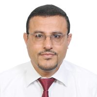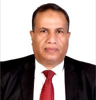
Yahia Mohamed Hasan Al-Haifi
Assistant Professor
Personal Information:
FULL NAME: Yahia Mohamed Hasan Al-Haifi
PROFESSION: Assistance Professor of Engineering Surveying and Geodesy/Consulting Engineer
NATIONALITY: Yemeni
DATE OF BIRTH: 1 / 8 / 1956
Summary:
- Full time assistant professor of engineering surveying and geodesy at Civil Eng. Dept., Faculty of Eng., Sana’a University since September 1996 up to now.
- Lecturer of applied statistics for civil engineering postgraduate and under graduate students between years 1997 and 2013.
- Lecturer of computer applications for civil engineering undergraduates between years 1998 and 2013.
- Occasional part time lecturer of engineering surveying and geodesy at private universities in Sana’a from 1996 up to 2003 (University of Science and Technology, Saba University) and from November 2015 up to now at Faculty of Engineering, IUTT University.
- Assistant lecturer of engineering surveying and geodesy at Civil Eng. Dept., Faculty of Eng., Sana’a University from September 1989 up to July 1992.
- Demonstrator of engineering surveying and geodesy at Civil Eng. Dept., Faculty of Eng., Sana’a University from January 1985 up to July 1987.
Education:
- D. in High Precision GPS Positioning for Engineering Surveying, University of Newcastle upon Tyne, UK, 1996.
- Sc. in Engineering Surveying and Geodesy, University of Nottingham, UK, 1989.
- Sc. in Surveying Engineering, Shoubra- Cairo, Zagazig University, Egypt, 1983.
Experience:
ACADEMIC PROFFICINCY:
- Full time assistant professor of engineering surveying and geodesy at Civil Eng. Dept., Faculty of Eng., Sana’a University since September 1996 up to now.
- Lecturer of applied statistics for civil engineering postgraduate and under graduate students between years 1997 and 2013.
- Lecturer of computer applications for civil engineering undergraduates between years 1998 and 2013.
- Occasional part time lecturer of engineering surveying and geodesy at private universities in Sana’a from 1996 up to 2003 (University of Science and Technology, Saba University) and from November 2015 up to now at Faculty of Engineering, IUTT University.
- Assistant lecturer of engineering surveying and geodesy at Civil Eng. Dept., Faculty of Eng., Sana’a University from September 1989 up to July 1992.
- Demonstrator of engineering surveying and geodesy at Civil Eng. Dept., Faculty of Eng., Sana’a University from January 1985 up to July 1987.
ADMINISTRATIVE POSITIONS HELD:
- Head of the Civil Engineering Department at the Faculty of Engineering between years 1998 and 2001.
- Director of Engineering Consultancy Center at the Faculty of Engineering, Sana’a University, from September 1999 up to July 2003.
NON-ACADEMIC PROFESSIONAL RECORD:
Provided geodetic surveying, engineering surveying and road engineering surveying consultancy works for the following:
- Engineering Consulting Center, Faculty of Eng., Sana’a University, Yemen from September 1996 up to now.
- Ministry of Public Works and Highways, Roads Sector, Yemen, from May2005 up to now.
- Amran-Aden Dual Carriage Strategic Road Project Implementation Unit, Ministry of Public Works and Highways, Yemen, 2009-2010, 2013-2014.
- Road Maintenance Fund, Ministry of Public Works and Highways, Yemen, 2010-2011.
- Surveying and Engineering Studies Center, Yemen, from January 2003 October 2010.
- Military Engineering Corporation, Yemen, from January2003 up to June 2006
- Gulf Surveys of Yemen, from year 2000 up to now.
- The Professional for Engineering and Development (previously Aljolahy for Engineering Services), Yemen, from 2004 up to now.
- Ryman Engineering Office, Yemen, from 2011 up to now.
- High Authority for Tender Control, Yemen, during the years 2012 and 2013.
- Mukbil Mubarak and brothers Establishment, Yemen, during the years 2004 and 2005.
- Dar Alhekmah Engineering Office, Yemen, during the years 2003 and 2004.
- Alasas Engineering Office, during the year 2003.
- Nasher Engineering Office, Yemen, from 1998 to 2002.
- Ghamdhan Alquhali Corporation, Yemen, during the years 1997 and 1998.
- Run training courses on geodetic and navigation GPS, Total Stations and surveying techniques for the following:
- Ministry of Public Works and Highways, from2011 up to 2020.
- Department of Public Work at Sana’a Governorate, 2020.
- Rural Water Corporation, 2006
- Nasher Engineering Office, from 1998 to 2002
- Ministry of Agricultural and Irrigation, 1999
Skills:
- Planning, managing, and running various basic and advanced geodetic/plane surveying and related topic courses and conducting training on a long or short period basis. As well as conducting seminars and talks for surveying oriented institutions.
- Consulting, managing, planning and carrying out field and office surveying work-studies for geodetic/plane surveying and engineering projects as well as analyzing captured data and obtained results with high standards. Mostly, in all precise survey works including:-
- GPS satellite surveying for various applications using any of the geodetic single or dual frequency GPS/GNSS receiver trademarks and relevant data processing packages (e.g. Leica’s LGO, Trimble’s TGO, TBC and TTC), as well as using the MOVE3 3-D geodetic network adjustment and analyzing software.
- Road projects planning, studying and designing (using Autodesk Land Desktop/ C3D software and Bentley MXROAD software).
- Detail and topographical survey mapping on large or small scales, using up-to-date survey techniques, instrumentation and softwares (e.g. GPS/GIS’s Global Mapper and/or EDM Total Stations; Autodesk Land Desktop and similar drawing softwares), as well as conventional survey methods and instrumentation.
- Taking over and assessing the quality of various surveying works (geodetic networks, Lidar, photogrammetrical and an RTK generated DTMs) for infrastructures.
- Good to very good knowledge in Photogrammetry, Remote Sensing and GIS technologies.
- Very good to excellent knowledge in:
- Computing, GPS data processing and analyzing using C/C++ compilers, word-processing, spreadsheets, Autodesk Land Desktop/C3D, Bentley MXROAD, Internet and other general advanced Information Technology (IT) skills.
- English and professional report writing.
Conferences and Workshops:
- Participated in various local workshops
- Participated in a regional scientific conference in Bahrain (2009)
- Participated in a regional scientific conference in Saudi Arabia (2010)
- Attended one week training course on MXROAD Design Package in Dubai, UAE (2008)
- Attended a week long surveying workshop at Leica Geosystems AG, Heerbrugg, Switzerland (2002)
Research and scientific papers:
- Number of research work papers (5 scientific papers) published in two regional conferences, international journal, and in two papers are ready for publication.
- Research interests are in the modern engineering surveying technologies and Global Positioning Satellite based Techniques (GPS/GNSS).
771885702
