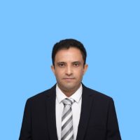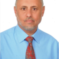
Khaled Mohammed Omer KHANBARI
Sample CV for faculty members at Sana’a University (English)
Personal Information:
Name: Khaled Mohammed Omer KHANBARI
E-mail: kkhanbari@hotmail.com
Address: Residence of academic members – Sana’a University – Sana’a – Republic of Yemen
Date and place of birth: 17th April, 1967, Al-Mukalla, Hadramout Governorate, Republic of Yemen
Social status: Married
Occupation: Professor of Geology, Faculty of Petroleum and Mineral Resources, Sana’a University
Summary: (A brief profile Summary of the faculty member at least 3 lines)
Khaled Khanbari has a PhD in Geology. Université Paris Sud, France. He is Professor at the Faculty of Petroleum and Mineral Resources, Sana’a University. Dr. Khanbari is also chairman of Yemen Remote Sensing and GIS Center. Dr. Khanbari has good relationship and experiences on research activities in Geoscience with the French PMCU University. He coordinated one Yemeni-French scientific project YOCMAL which aims to study the geology of Socotra Island and the evolution of the Gulf of Aden. Dr. Khanbari improved his qualification on Geology, GIS and Remote Sensing by attending many of local and regional workshops and conferences. He supervised many of bachelor final projects and master thesis in the fields of Geology and Remote Sensing. He has published many of scientific articles in local and international scientific journals.
Education:
1990: Bachelor of Science (B. Sc.) in Geology, Faculty of Science,
Kuwait University, Kuwait.
1995: Diploma of French language, CAVILAM, Vichy, France.
1996: Master Degree (M. Sc.), Geodynamic and Physic of the Earth,
École Normale Supérieure – University Paris Sud, Paris, France.
2000: Ph. D., «Research Topic- Propagation of an oceanic rift : The Gulf
of Aden, Its structural effects on the margin of Yemen », École
Normale Supérieure – University Paris Sud, Paris, France.
Experience:
1991-1994: Assistant Teacher, Department of Earth and Environmental
Science, Sana’a University.
1992-1994: Participation in the many field works to study the geology
of Yemen.
August – September 1995: Participation in the TADJOURADEN cruise
in the Gulf of Aden to study the propagation
of the rift, French project.
December 2000: Participation in the ADEN-NEW-CENTURY cruise in
the Gulf of Aden to study the evolution of the rift,
Japanese project.
March 2001: GPS measurements to study the movement of Arabian
Plate, French Project.
March 2004: Field work with French group from university of Paris-6, to
study the geology of Socotra Island.
September 2005 – March 2014: Vice-chairman of Yemen Remote
Sensing and GIS Center.
2007 – Till date: Coordinate of the Yemeni side for French project
YOCMAL which aims to study the geology of Socotra
Island, margin of Yemen and the evolution of the Gulf
of Aden.
2007 – Till date: Chairman of the technical team and member of
technical committee of continental shelf of Republic of
Yemen.
March 2014 – Till date: Chairman of Yemen Remote Sensing and GIS
Center.
Conferences and Workshops:
- Workshop on “using remote sensing and GIS techniques for coastal zone management of the Arab world”, 20-23 October 2002, Cairo, Egypt.
- Conference of Sciences, June 2004, Taiz, Yemen.
- The second Cairo University Workshop on Geological and Environmental Applications of Remote Sensing, 14-16 March 2005, Cairo, Egypt.
- Regional workshop on the role of spatial analysis in resources management of biosphere reserves in Arab World, 5-7th June 2006, Sana’a, Yemen.
- Workshop on “Progressing Towards Yemen Spatial Data Infrastructure”, 3rd March 2008, Sana’a, Yemen.
- 9th International Conference on the Geology of the Arab World “GAW9”, 24-27th March, 2008, Cairo University, Egypt.
- SPOT Image International Conference, 10-11 June 2009, Toulouse, France.
- Workshop on “Applications of Remote Sensing for Water Management”, 25‐27th October 2009, Abu Dhabi, United Arab Emirates.
- 5th workshop of the International Lithosphere Program -Task Force on Sedimentary Basins, 6-11 December 2009, Abu Dhabi, United Arab Emirates.
- 8th Gulf Seismic Forum, 3-6 March 2013, Muscat, Oman.
- The First Arab Conference on “Surveying and Geographical Names”, 29-31 October 2013, Amman, Jordan.
- Space Science and Remote Sensing Symposium, 16th October 2017, Sana’a, Yemen.
- 10th Gulf Seismic Forum, 19-22 March 2018, Muscat, Oman.
- Second International Conference on Advanced Geospatial Science & Technology, 26-28 September 2018, Tunis.
- International training workshop entitled “Delimiting Maritime Boundaries”, 5-6 December 2019, Paris, France.
- Workshop on “Decision makers and benefit from the uses of space technologies in sustainable development”, 9-11 September 2019, Cairo, Egypt.
- The second symposium on “Remote Sensing in Reconstruction and Sustainable Development in Yemen”, 4-10 October 2020, Sana’a, Yemen.
Research and scientific papers:
- Geoffroy L., Huchon P. et Khanbari K., 1998, Did Yemeni Tertiary granites intrude neck zones of a stretched continental upper crust ?. Terra Nova, V. 10, P. 169-200.
- Hébert H., Deplus C., Huchon P., Khanbari K. et Audin L., 2001, Lithospheric structure of a nascent spreading ridge inferred from gravity data: the western Gulf of Aden, Geophys. Res., V. 106, P. 345-363.
- Huchon P., Khanbari K., 2003, Rotation of the syn-rift stress field of the northern Gulf of Aden, Yemen. Tectonophysics, V. 364, P. 147-166.
- Khanbari K., 2004, Using Remote Sensing, GIS and Field Data for Fracture Analysis of Wadi Dhar Area, Republic of Yemen, Faculty of Science Bulletin, Sanaa University, V. 17, P. 91-102.
- Vigny C., Huchon P., Ruegg JC., Khanbari K., Asfaw L., 2006, New GPS data in Yemen confirm slow Arabia plate motion, J. Res., V. 111, B02402.
- Al-Subai K., Khanbari K., 2006, Regional Rock Quality Designation (RRQD) of Sana’a Basin, Yemen Republic, Assiut Univ. J. of Geology, 35, P. 83-93.
- Fournier M., Huchon P., Khanbari K., Leroy S., 2007, Segmentation and along-strike asymmetry of the passive margin in Socotra, eastern Gulf of Aden: Are they controlled by detachment faults?, G3,
- Vigny C., De Chabalier JB, Ruegg JC., Huchon P., Feigl K, Cattin R, Asfaw L., Khanbari K., 2007, Twenty-five years of geodetic measurements along the Tadjoura-Asal rift system, Djibouti, East Africa, J. Res., V. 112, B06410.
- Khanbari K., 2008, Study of Structures and Tectonic Evolution of Yemen Tertiary Granites, by Using Remote Sensing Technique, of Remote Sensing issued by GORS, v. 21, P 63-72.
- Khanbari K., Huchon P., 2010, Paleostress analysis of the volcanic margins of Yemen, Arab J Geosci, 3:529-538.
- Fournier M., Chamot-Rooke N., Petit C., Huchon P., Al-Kathiri A., Audin L., Beslier M.O., D’Acremont E., Fabbri O., Fleury JM., Khanbari K., Lepvrier C., Leroy S., Maillot B. and Merkouriev S., 2010, Arabia-Somalia plate kinematics, evolution of the Aden –Owen-Carlsberg triple junction, and opening of the Gulf of Aden, J. Res.,V. 115, B04102.
- Leroy S., Lucazeau F., D’Acremont A., Wateremez L., Autin J., Rouzo S., Bellahsen N., Tiberi N., Ebinger C., Beslier MO., Perrot J., Razin P., Rolandone F., Sloan H., Stuart G., Al-Lazki A., Al-Toubi K., Bache F., Bonneville A., Goutorbe B., Huchon P., Unternehr P., Khanbari K., 2010, Contrasted styles of rifting in the eastern Gulf of Aden: A combined wide-angle, multichannel seismic, and heat flow survey, G3, V. 11, Q07004.
- Denele Y., Leroy S., Pelleter E., Pik R., Talbot JY., Khanbari K., 2011, The Cryogenian arc formation and successive high-K calc-alkaline plutons of Socotra Island (Yemen), Arab J Geosci, DOI 10. 1007/s12517-011-0476-3.
- Sylvie Leroy, Philippe Razin, Julia Autin, François Bache, Elia d’Acremont, Louise Watremez, Jérémy Robinet & Céline Baurion, Yoann Denèle, Nicolas Bellahsen, Francis Lucazeau, Frédérique Rolandone, Stéphane Rouzo, Josep Serra Kiel, Cécile Robin, François Guillocheau, Christel Tiberi, Clémence Basuyau, Marie Odile Beslier, Cynthia Ebinger, Graham Stuart, Abdulhakim Ahmed, Khaled Khanbari, Ismael Al Ganad, Philippe de Clarens, Patrick Unternehr, Khalfan Al Toubi, Ali Al Lazk, 2011, From rifting to oceanic spreading in the Gulf of Aden: a synthesis, Arab J Geosci, DOI 10.1007/s12517-011-0475-4.
- Hisham M. Nagi, Khaled M. Khanbari and Ameen Al Sameh, 2012, ESTIMATING TOTAL AREA OF MANGROVE HABITATS IN THE REPUBLIC OF YEMEN USING REMOTE SENSING AND GIS, Faculty of Science Bulletin, Sana’a University, 24, P 75-84.
- Abdulhakim Ahmed, Christel Tiberi, Sylvie Leroy, Graham W. Stuart, Derek Keir, Jamal Sholan, Khaled Khanbari, Ismael Al-Ganad8 and Clemence Basuyau, 2013, Crustal structure of the rifted volcanic margins and uplifted plateau of Western Yemen from receiver function analysis, J. Int., doi: 10.1093/gji/ggt072.
- Bellahsen, S. Leroy, J. Autin, P. Razin, E. d’Acremont, H. Sloan, R. Pik, A. Ahmed, K. Khanbari, 2013, Pre-existing oblique transfer zones and transfer/transform relationships in continental margins: New insights from the southeastern Gulf of Aden, Socotra Island, Yemen, Tectonophysics 607 (2013) 32–50.
- Raphaël Pik, Nicolas Bellahsen, Sylvie Leroy, Yoann Denèle, Philippe Razin, Abdulhakim Ahmed, Khaled Khanbari, 2013, Structural control of basement denudation during rifting revealed by low-temperature (U–Th–Sm)/He thermochronology of the Socotra Island basement—Southern Gulf of Aden margin, Tectonophysics 607 (2013) 17–31.
- Abdulhakim Ahmed, Sylvie Leroy, Derek Keir, Félicie Korostelev, Khaled Khanbari, Frédérique Rolandone, Graham Stuart, Mathias Obrebsk, 2014, Crustal structure of the Gulf of Aden southern margin: Evidence from receiver functions on Socotra Island (Yemen), Tectonophysics 637 (2014) 251–267.
- Corbeau, F. Rolandone, S. Leroy, A. Al-Lazki, A.L. Stork, D. Keir, G.W. Stuart, J.O.S. Hammond, C. Doubre, J. Vergne, A. Ahmed, and K. Khanbari, 2014, Uppermost mantle velocity from Pn tomography in the Gulf of Aden, Geospher, v. 10; no. 5, doi:10.1130/GES01052.1.
- Korostelev F., Basuyau C., Leroy S., Tiberi C., Ahmed A., Stuart G. W., Keir D., Rolandone F., Ganad I., Khanbari K. and others, 2014, Crustal and upper mantle structure beneath south-western margin of the arabian peninsula from teleseismic tomography, Geochemistry, Geophysics, Geosystems, 15(7), pp. 2850–2864.
- Korostelev, F., Leroy, S., Keir, D., Weemstra, C., Boschi, L., Molinari, I., Ahmed, A., Stuart, G.W., Rolandone, F., Khanbari, K., Al-Lazki, A., 2015, Magmatism at continental passive margins inferred from Ambient-Noise Phase-velocity in the Gulf of Aden. Terra Nova, doi: 10.1111/ter.12182.
- Korostelev, F., Leroy, S., Keir, D., Ahmed, A., Boschi, L., Rolandone, F., Stuart, G.W., Obrebski, M., Khanbari, K., El-Hussain, I., 2015, Upper mantle structure of the southern Arabian margin: Insights from teleseismic tomography, GEOSPHERE; v. 11, no. 5. doi:10.1130/GES01159.1.
- Korostelev, F., Weemstra, C., Leroy, S., Boschi, L., Keir, D., Ren, Y., Molinari, I., Ahmed, A., Stuart, G.W., Rolandone, F., Khanbari, K., Hammond, J., Kendall, J. M., Doubre , C., Al Ganad, I., Goitom, B., Ayele, A., 2015, Magmatism on rift flanks: Insights fromambient noise phase velocity in Afar region, Res. Lett., 42, 2179–2188, doi:10.1002/2015GL063259.
- Fuad Al-Nahmi, Hassan Rhinane, Atika Hilali, Khaled Khanbari, 2015,Using Landsat 8_OLI and Aster satellite image for extraction of lineament in Al Mahabishah -Hajjah area –Yemen, International Journal of Geosciences and Geomatics, Vol. 3, Issue 1, 2015,ISSN:2052-5591.
- Khaled Khanbari, 2015, Structural Analysis and Tertiary Tectonic Evolution of Yemen, Faculty of Science Bulletin, 27 (2015), 75-87, Sana’a University, ISSN 1684-100X.
- Abdulhakim Ahmed, Cecile Doubre, Sylvie Leroy, Kassim, Derek Keir, A. Abayazid, Julie Perrot, Laurence Audin, Jerome Vergne, Alexandre Nercessian, Eric Jacques, Khaled Khanbari, Jamal Sholan, Frédérique Rolandone, Ismail Al-Ganad, 2016, Seafloor spreading event in western Gulf of Aden during the November 2010 – March 2011 period captured by regional seismic networks: Evidence for diking events and interactions with a nascent transform zone, Geophysical Journal International 205:1244-1266.
- Al-Nahmi F., Alami O. B., Baidder L., Khanbari K., , Rhinane H., Hilali A., 2016, Using Remote Sensing for Lineament Extraction in Al Maghrabah area – Hajjah, Yemen, The International Archives of the Photogrammetry, Remote Sensing and Spatial Information Sciences, Volume XLII-2/W1.
- Al-Nahmi F., Saddiqi O., Hilali A., Rhinane H., Baidder L., El arabi H., Khanbari K, 2017, Application of Remote Sensing in Geological Mapping case study Al Mahabishah area -Hajjah region, Yemen, ISPRS Annals of the Photogrammetry, Remote Sensing and Spatial Information Sciences, Volume IV-4/W4.
- Chloé Nonn, Sylvie Leroy, Khaled Khanbari and Abdulhakim Ahmed, 2017, Tectono-sedimentary evolution of the eastern Gulf of Aden conjugate passive margins: Narrowness and asymmetry in oblique rifting context, Tectonophysics 721, 322–348.
- Adnan A. Barahim, Khaled M. Khanbari, Amal F. Algodami, Ziad A. Almadhaji and Ahmed M. Adris, 2018, Slope Stability Assessment and Landslide Susceptibility Map Production of Wadi Dhahr Area, Northwest of Sana’a, Yemen, Sultan Qaboos University Journal for Science, 23(2), 120-136.
- AL-AKAD Sultan1, AKENSOUS Youness , HAKDAOUI Mustapha, AL-NAHMI Fuad, MAHYOUB Sulaiman, KHANBARI Khaled, SWADI Hassan, 2019, MAPPING OF LAND-COVER CHANGE ANALYSIS IN MA’RIB AT YEMEN USING REMOTE SENSING AND GIS TECHNIQUES, The International Archives of the Photogrammetry, Remote Sensing and Spatial Information Sciences, Volume XLII-4/W12.
- Khaled Khanbari, Sylvie Leroy, Ahmad Adris, Sami Moheb-Al-Deen and Waheed Al-Sarari, Study of Fractures Network in the Basement of Socotra Island—Yemen by Using Remote Sensing and GIS Techniques, Springer Nature Switzerland AG 2020, Space Fostering African Societies, Southern Space Studies, 207-218, https://doi.org/10.1007/978-3-030-32930-3_14.
- Khaled Khanbari, 2020, Seismotectonic Provinces of Yemen, Journal of Science and Space Technologies, CRTEAN, No. 6 (December 2020), P. 8-22.
